 This is the Web Edition of "A Trip Into Space", a Coimbra-based electronic book on space science. Both the texts and the photos are by courtesy of National Aeronautics and Space Administration.
| This is the Web Edition of "A Trip Into Space", a Coimbra-based electronic book on space science. Both the texts and the photos are by courtesy of National Aeronautics and Space Administration.
|
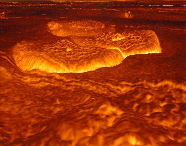
A Trip Into Space  Venus Surface Views Venus - "Pancake Domes" In Alpha Regio Venus Surface Views Venus - "Pancake Domes" In Alpha Regio |
|
| See also: Venus Fact Sheet |   |
Last Update: 2005-Nov-29